Space sector seeking to contribute more to national development
- Natural resources minister pledges more transparency
- Diplomacy contributes to national development
- Gov’t leader requests resolve, aspiration for national development
- Encouraging OVs to ‘give back’ to national development
- Religious people's great contributions to national development praised
Since its first satellite was launched in 2013, Vietnam has focused on applying remote sensing satellite imaging to socio-economic development.
According to the National Satellite Center, so far 1,420 satellites have been launched into space by countries all over the world for different purposes, including 360 Earth observation satellites. The United States operates 43 earth observation satellites, China has 40 while Japan runs 18.
 |
| Since its first satellite was launched in 2013, Vietnam has focused on applying remote sensing satellite imaging to socio-economic development. |
The number of earth observation satellites has increased since 2000, which has led to an idea that countries are on a race of satellite technology with the aim of collecting more data for socio-economic development as well as defense and security.
In Vietnam, the space technology was started in the late 1970s when preparing for the flight into the space of the first Vietnamese citizen, hero Pham Tuan, in 1980.
However for a number of reasons, some projects on space technology were cancelled.
Efforts for researching and applying space technology were not renewed until 2006 or 25 years later, when the Prime Minister adopted the National Strategy for Research and Applications of Space Technology.
Since then, along with the construction of technical infrastructure for the Vietnam Space Centre in Hoa Lac, and launching small satellites into space, Vietnam has been investing in developing human resources for space technology and cosmology; researching and manufacturing satellites; and promoting the application of satellite imaging data to socio-economic development. Today,
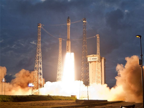
After years of preparation, Vietnam’s first remote sensing satellite, VNRED Sat-1, was launched by Arianespace from the Guiana Space Center, French Guiana on May 2013. Since then, VNRED Sat-1 has stably operated in the orbit and transferred many pictures to the ground stations.
According to Dr. Bui Trong Tuyen, Director of the Institute of Space Technology, over the past 3 years operating in the orbit, VNRED Sat- 1 has taken 58,000 landscape photographs, including 31,480 photos of Vietnam’s territorial areas; 23,300 photo of different areas all over the world.
The first Vietnamese earth observation satellite has provided ministries, branches and localities with 14000 high-resolution satellite images, serving territory management and natural disaster detection, environmental protection and climate change phenomena.
However, the use of satellite data has been limited; and as a result, Vietnam has still had to purchase a number of images from other countries at high prices. Moreover, the lifespan of VNREDsat-1 is only 5-7 years.
Against this backdrop, the Vietnam Science and Technology Academy has been assigned to cooperate with its Japanese partner to manufacture and launch a satellite of LOTUsat-1 that can take images in all weather conditions, by 2019.
The combination of the two kinds of satellites is expected to bring about good outcomes, contributing more to national socio-economic development.
There still remain questions, such as how to integrate infrastructure on ground and satellites, and how to promote good coordination among the Vietnam Science and Technology Academy, the National Remote Sensing Department and other relevant agencies and organizations, so as to exploit and apply satellite data to national socio-economic development effectively and efficiently.