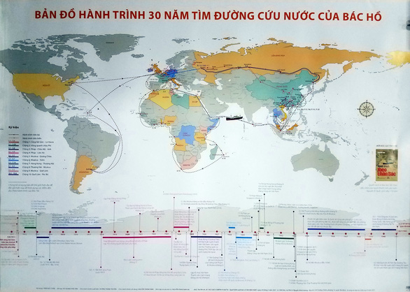
Map of Uncle Ho's 30-year national salvation journey published
- 300 photos of Uncle Ho on display at Presidential Palace
- Uncle Ho’s contributions to fight against racism highlighted
 |
The map, one meter in width and 70 centimeters in height, is printed in color. It illustrates Uncle Ho’s journey for national salvation as well as highlights the President’s revolutionary activities from June 5, 1911 to January 28, 1941.
According to Mr. Duong Thanh Truyen, acting Director of the Tre Publishing House, the map helps viewers easily visualize, track and look up information about the journey of Uncle Ho in relations to the current geopolitical context.
The map is suitable for use in libraries, Youth Union offices, social associations’ centers, meeting rooms of agencies, departments, organizations, as well as hall of tradition of armed forces units.
The map can also serve education activities.
The entire 30-year national salvation journey of Uncle’s Ho is highlighted in the 100x70cm world map. At the bottom of the map is a graph showing the timeline of his journey with historical data.

